Did you know that the Uncompahgre river (the largest tributary to the Gunnison River) is approximately 75 miles long from the headwaters in Lake Como to it’s mouth in Delta? In that journey it drops about 7,300 ft. That is two and a half times the height of the world’s tallest building in Dubai, or the equivalent of 430 stories.
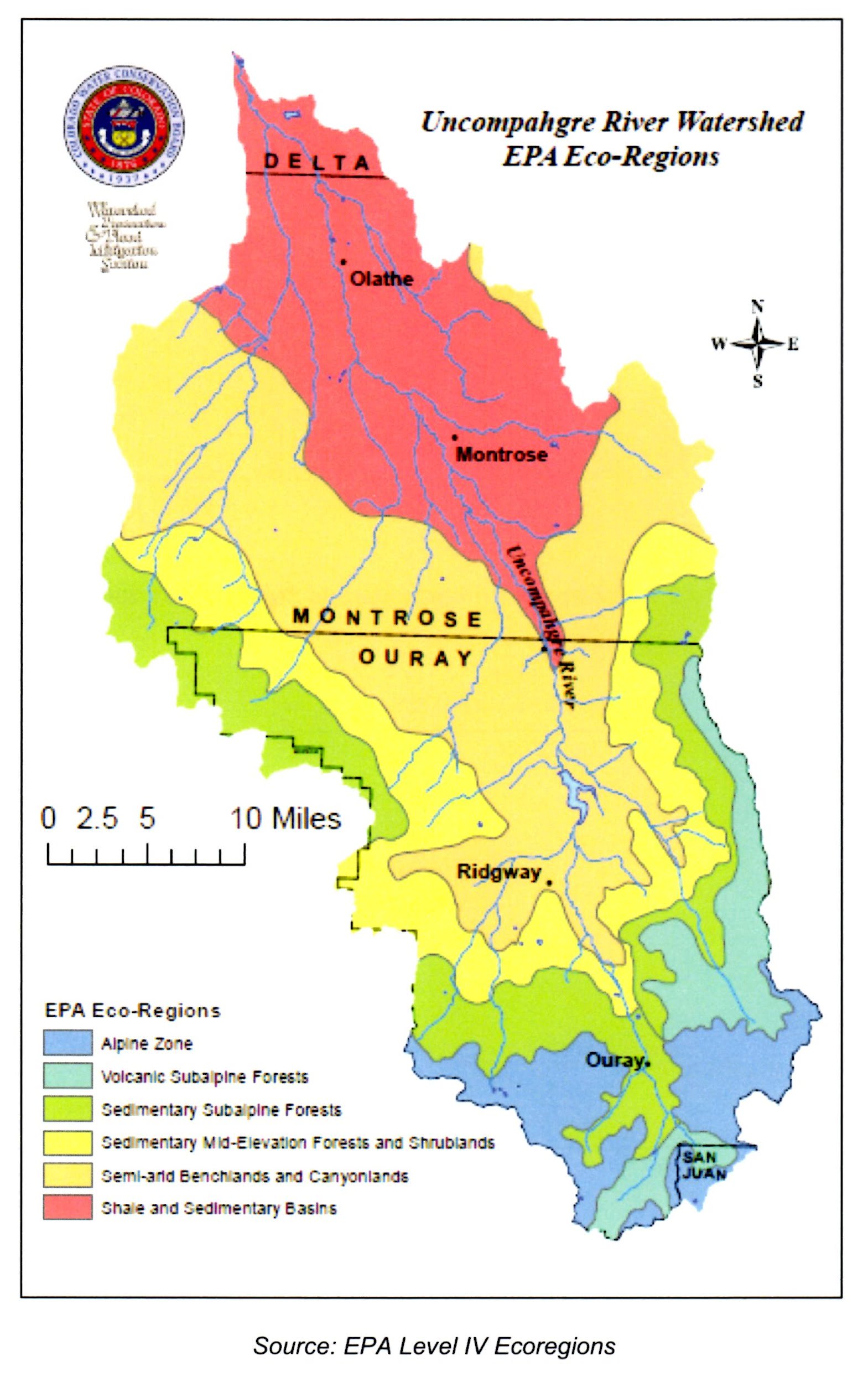
The drop in elevation combined with the variability in precipitation in the watershed contributes to the variety of eco-regions and wildlife that lives in our watershed. The climate in the northern region of the watershed is semi-arid with low relative humidity. Precipitation is less than ten inches per year. Maximum monthly rainfall usually occurs in August (1.12 inches). Winters are mild with occasional snowfall and summers are hot and dry.
Above 7,000 feet, the climate changes to more mountainous conditions with an increase in precipitation and cooler temperatures. Annual precipitation averages over 30 inches in the high mountains. Ouray sees an average of 140 inches of snowfall a year.
The seasonal flow patterns of the Uncompahgre River include a low, base-flow period that runs from August through April followed by a high flow period that runs from May through July. Peak flows occur in May and June due to snowmelt runoff. Average flow rates above the Town of Ridgway range between 100 and 200 cfs with peaks as high as 2,000 cfs. At Delta the average flows range between 150 to 400 cfs with peaks as high as 5,500 cfs. Unline the Uncompahgre at Ridgway, elevated fall flows are common in the lower Uncompahgre River. This is in part due to declining end of season irrigation withdrawals and increased fall precipitation.

Selected stream flows in the Uncompahre Watershed are continuously measured at a number of real-time flow gaging stations monitored by the U.S. Geological Survey. In addition the National Oceanic and Atmospheric Administration (NOAA) and the Natural Resource Conservation Service (NRCS) measure snowpack to gauge water supply. You can check out current river conditions by using many of the tools listed on our Monitoring Water and Snowpack page.
(from the Uncompahgre Watershed Plan)